Monday, 8 June 2009

Pin The Tail On The Donkey..

Following my last blog on the subject of the intricacies of canal navigation, "there are two sides to every coin". 

It's not just a question of how to determine your location; it's also a matter of how to let everybody know where you are ??

My response is a little tongue-in-cheek !!!

What is it about boaters that makes them want to tell everybody their location ? :-)

Many boaty blogs and websites these days, have locator panels showing their readers the position of their boat.

Now, to be honest, I don't fit the mould.

The Internet is a wonderful thing, but the World-Wide bit is just that.

Anybody and everybody can look at it.

99.9% of us are 99.9% sane, but the 0.01% are 100% certifiable.

Willawaw is our home (well, second home) and the thought of every psycho knowing our exact location doesn't greatly appeal.

For this reason, we go to some lengths to not show detailed images of the boat or her exact position in real time.

However, the technology pertaining to boat locating fascinates me, so it's something of a conundrum, as I'm sure you can appreciate.

There appears to be two main ways of transmitting your location, for the World to see.

Water Explorer is a software devised by Stuart, owner of DuskTill Dawn. Stuart is involved with the writing of software for a living, but has been developing W.E in his spare time.

It has taken him a couple of years.

I tried it initially, but couldn't get on with it at first.

He is gradually ironing out bugs and improving it's features and ease of use.

Its quite clever in it's principle, because you don't need to have a GPS.

You can operate it from either a laptop with an internet connection or even a mobile phone with the ability to browse the Internet.

In essence, you tell the programme where you intend to start your journey (by clicking on a bridge or lock number). When you pass under or through subsequent bridges or locks, you click on a website link confirming their numbers.

This enables the programme to identify you progress and because you are actually telling it the elapsed time between each geographical point, it can calculate your average speed and distance run.

Water Explorer then plots your progress on the website in a nationwide boat plot.    

The boats are plotted against a Google Earth satellite image or Google Maps background and smoke trails show where they have been.

There is also a facility which allows bloggers to link this information to their blogs.

Some boaters like John and Fiona Slee on NB Epiphany are trialling a derivative of Water Explorer called Navvygator, which allows the position to be plotted automatically, with the use of a GPS and a laptop.

The movements of Epiphany using this method can be seen here:

http://nbepiphany.co.uk/jcms/index.php?option=com_content&view=section&layout=blog&id=11&Itemid=124 

The other method which is ideal for bloggers, is Google Latitude.

This is a general social-positioning software which allows friends to keep track of each other.

Google Latitude allows you to update your location from a mobile or laptop using an internet connection. This can then also be linked to a blog or website.

After playing with both methods, I decided to go with the latter.

Going back to my earlier dichotomy of not wanting to publish our exact position, but wanting to participate in the technology, I decided to use Google Latitude, but impose a time delay in the positions, so they don't represent our current position.

You can see the result on the left of this text.

Heady stuff and it makes a blog or cruising diary, a little more interesting for the reader when they can see the boat moving in real time (albeit in the case of Willawaw, historically).

Perhaps more bloggers will embrace the technology ?

Existing users of Google Latitude already include well known canal bloggers like Granny Buttons. 

Sunday, 7 June 2009

Spot On !!

I must admit to being something of a cartography fan.

I like maps - I like reading them and even making them.

It probably stems from having a cr*p sense of direction. I am infamous in my family for being able to get totally lost unless I am near water.

Technological leaps in satellite navigation for land and road use have lead to various discussions in the forums about using GPS on the canals.

Of course, everybody knows that you don't really need GPS on the canals. If you have a decent paper map guide like Nicholsons, Pearsons, etc, there are enough landmarks to find your position and look out for the next feature.

However, that would be no fun now, would it ?

and boys do like their toys !!

We use an old Magellan GPS (monochrome screen; no mapping) as a speedometer. It's useful to be able to see your speed-over-the-ground and compare it with the 4 mph speed limit rule, especially when challenged by some miserable old bugger for going too fast. 

4 mph is often referred to as a fast walking pace, but in actual fact, it's a very FAST walking pace and we certainly tend to average a much slower speed (2.5 - 3 mph).

Our GPS is also quite useful in that it displays the compass heading (Course-Over-Ground to be pedantic) that you are following.

As Nicholsons maps are aligned to North, on long stretches of feature-less rivers or canals, it will allow you to see roughly where you are. All you have to do is compare the heading on the GPS with the direction, the river/canal is following on the map.

If the GPS says you are travelling 090 degrees (East), then you look for the stretch of water that runs East-West and the chances are that you are somewhere on that stretch.

A few techno-freak boaters have said to me that it would be useful to have their canal maps on the screen of a handheld device instead of having to refer to a flapping, rain-specked, paper book that keeps trying to make suicidal leaps over the rail into the cut.

I can see their point, but due to the small map screen on any handheld device and bearing in mind the amount of detail needed, it must be like wall-papering your hall through the letterbox, from the front garden. Also, most screens don't like sunny days, when we try to do most of our boating.

We have a little GPS module that connects to the laptop by USB and which will enable us to pinpoint our position on a map background on the laptop. We have used this more on tidal passages like the Severn estuary, where we used proper electronic navigation charts (e.g. the British Admiralty charts provided by Memory Map or the RYA).

It will also work on the canals using an Ordnance Survey electronic map as a background (again, available from Memory Map), but who needs a laptop on the roof when you are cruising ?

EurEauWeb is a company based at Braunston who have developed a canal navigation software, which can run on a laptop or mobile device.

I've never used it, or met anybody who has, but it seems to hit the spot.

Their website proclaims that it is developed for boaters by boaters. It appears to do all the right things, contains all the Nicholsons information and when it runs on a laptop, offers full route planning.

River Canal Rescue use it and EEW have many sales agents around the marinas.

The only problem I can see, is the price.

It costs £129.99 just for the software plus £25 per annum for the updates.

Mind you, have you seen the cost for a full set of updated Nicholsons ??  

Personally, I would advise EurEauWeb to break down their maps into regions and sell them at a lower price, region by region.

Some boaters might spend £25 for just one region, where they are unlikely to fork out £130 for the whole of the UK waterways, which they might never get to explore in their own boat. 

As canal boaters tend to take pleasure from boating at the least possible cost, another way to tackle the issue is to make your own maps.

One of the things that irks me, is when I buy a new Nicholsons book for £13-14 and discover when I want to use it, that some things are out of date.

Online updating is something that has intrigued me for a while.

To test this, I produced my own waterways guides for the River Lee and Stort, an area I know well.

The maps were created on a Google Earth background as an overlay (in .KMZ format).

My idea was that if every boater produced a map guide for their own territory, roughly to a common list of symbols, then the resultant maps could be shared on a free exchange basis.

The map files are very small and therefore very easy to store on a website as a download or even e-mail between boats.

Google Earth is a great resource.

It is very easy to work with. 

Apart from being able to show your map overlay, it also has a great search facility.

If you are moored in a specific area and need, for example, a vet for one of your pets, you just have to type "vets" in the "fly to" box in the top left corner of Google Earth.

The programme will then list out all the local vets and more importantly, show their locations on the map, as well as give you the telephone number, etc.

We have used this search facility a number of times as we travel, especially for taxi's and it works well. 

In summary, narrowboating is so slow, I really can't see satnavs catching on, in the same way that they have for road users.

However, there are some great spin-off's from the technology and I feel that these can be harnessed, generally quite inexpensively, to make boating life a lot easier.


Saturday, 6 June 2009

Please Speak Clearly After the Tone

I had a conversation with a group at work the other day, about companies and how they use their own internal terminology and special trade-related terms, when they talk to their customers.

Have you ever phoned a bank or an insurance company and had them speak gobbledegook down the line at you. They talk to you as if they are talking to one of their colleagues, using all the jargon of their trade.

When you don't understand because you don't deal in their line of business every day and ask them to slow down and clarify certain words, you can sense their impatience - they almost sigh and tut at you.

Banks and insurers are not the only culprits. My original discussion was sparked off by technical support people talking to some of my customers in part numbers.

I caught them doing it and challenged them. 

I would say that 9 times out of 10, they don't even realise they are doing it.

Office-based staff are so used to communicating like this, they just naturally assume that people outside of their work environment, will follow their conversation.

This inability to empathise is one of the biggest enemies of industry.

It's not confined to verbal communication either.

I received my new American Express credit card the other day (the cheap green one, not the gold or platinum one !!)

There was a little white sticker on the new credit card telling me to go to their website and activate now.

So, being the good, obedient little boy that I am, I did.

I dutifully filled in all the online card numbers and passwords to get through their security protection. It then asked me to enter the 4-digit identification number.

This confused me as I wasn't sure what number they meant.

I tried the number on the card after the account number - Amex.co.uk didn't like it

I tried my password number - Amex.co.uk didn't like it

I tried another number that might fit - Amex.co.uk didn't like it

I got locked out, for my own protection, of course.

Frustrated, I tore the stupid bit of white paper off the card and lo and behold, beneath it, was a little, barely visible, 4-digit number that I'd never seen on the old card before.

I tried to enter that, but the website very clearly and positively said that I had been locked out and should phone them up instead.

I called...

and spoke to a machine.

I dutifully keyed in my account number and a few other things that it asked for.

Eventually, the recorded voice in a pleasant Edinburgh accent, told me to call back when my old card had expired (another 3 weeks away).

What a complete waste of 30 minutes.

Ironically, the bill came the next day, asking me to pay them another £37.50

Now, it was quite clear to me that the person(s) who had written those instructions, had never actually tried to follow them with the knowledge base of a typical customer.

Of course, THEY, would know where the mystery 4-digit number was hiding.

It could all be avoided with a little bit of empathy. 

An old friend of mine used to write instruction manuals for the Marconi company.

In my opinion, Marconi manuals were one of the most concise and clearly written instruction books of all time.

His secret ?

When he had written a section, he used to get somebody like his long suffering wife, to read what he had written and see if there was any room for confusion or misunderstanding.

I pull an example of how not to do it, from the handbook for my new Blackberry:

Question. How to turn on the Speakerphone

Answer. During a call, press the Speakerphone key   

Thank goodness for that, I'd never have guessed.

It took me a full five minutes to find a key that passed for the speakerphone key (it had a little red speaker as a secondary function on the top of the tiny key cap)..

Speaking clearly is big business.

Companies have been formed to teach clear English to other companies.

The Plain Language Commission say:

"Every organization knows that customers and service users value clarity. So if you are making the effort to write your leaflets, forms, sales brochures and legal agreements in plain English, why not tell people?

Displaying the Clear English Standard helps you do this. It shows customers that your documents have passed a rigorous check of clarity, grammar and layout by experts in the field.

The Clear English Standard also gives you a competitive edge and a public-relations boost by reassuring customers that you've taken extra care to be clear.

Some of our accredited documents have gone to ten million UK households — probably the widest distribution of such material anywhere in the world. More than 10,000 documents bear the mark, so it probably appears on about 100 million printed items.

For many organizations, gaining the Clear English Standard for all their major public documents has become an essential part of customer care.

Its users include Standard Life, Financial Services Authority, Places For People, Companies House, The Insolvency Service, Zurich Financial Services, Birmingham City Council, Scottish Court Service, and the Foreign and Commonwealth Office".
 

Interesting, Standard Life and Zurich - both insurance companies..

Remember this the next time you need to make a claim.... 


Friday, 5 June 2009

Grembles and BW World

Today started off badly.

I was woken at dark o'clock by a cat doing a merengue on my head.

"Blue" wanted petting, then he wanted to go a'hunting.

After having ushered him out of the cratch door into the thinning blackness, I went back to bed and tried to get to sleep.

Then the Grembles came. 

Grembles are a cross between Gremblins and brain rumbles.

They are the thoughts of doom that race across your head in the early hours, when you are trying to get to sleep.

Is the boat now leaning at a slight angle, what is that dripping noise, did I remember to lock the back doors ??

If they're not about the boat, they're work thoughts - did I do this, did I do that, I wonder what will happen about those and so on. 

The brain races bravely on, while all you want to do is to shut it down and return to the warm, cosy world of SLEEP.

On a different note, we've ARRIVED.....

We are back in British Waterways world.

A few things have changed of course.

There seems a lot more moored boats along the canal, although that could be because, we have got used to not seeing that many.

One of the characteristics of the Fens, Middle Level and Nene is that there is no towpath and therefore, its quite hard to just moor anywhere.

Mooring has to be planned and there are little communities every few miles, which entertain tying up alongside. It gives you the feeling of little boaty journeys between civilisations.

Canals are more like a linear village with non-stop boats and people.

Just being moored and being passed by lots of boaters is a an experience that we've not seen for a while. On the Grand Union, it can be a bit like picnic'cing on the side of the M1. 

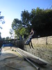
Cruising underneath the M1 Motorway between Northampton and Gayton Junction (the Rothersthorpe flight of locks).

Back to Black and White Locks at Rothersthorpe (is the licence cheaper ?)

Gayton Junction and the entrance to the "proper" Grand Union. Now, we just have to decide where to go next.

We have a few weeks before our drydocking slot, so we will just need to bimble around without going too far.

After drydocking, we have no idea where we are going.

That's the beauty of continuous cruising really !!

Thursday, 4 June 2009

Wave Hello

You might be seeing this logo a lot more as the year progresses.

Last week, Google launched the concept of their new Google Wave product at their I/O conference in San Franscisco.

In many respects, "Wave" is groundbreaking stuff.

Developed by a start-up team in Google Sydney, "Wave" is in its simplest form, an integrated combination of e-mail, instant messaging and other component parts like social networking, blogs, etc.

Up to now, each of these parts run independently in separate programmes and to some extent, it has been, never the twain shall meet.

Google have announced this product exceptionally early because they want other organisations to get involved. Google have already announced that this will be opensource code.

To achieve true integration, they need other developers to play along.

I can see some method in this digital madness. Google are now huge - they even operate the blog upon which I type.

If you are a big user of e-mail, have you ever noticed that if you send an e-mail covering a number of different topics in one mail, the person at the other end, will sometimes reply in red underneath each subject line, within the body of YOUR e-mail.

"Wave" follows through on this and e-mails become threads that are a cross between instant messaging and forum responses. E-mails can now occur in real time, with instant responses, people being added as the theme develops and so on.

If you want to know more, click on the You Tube movie above, but be warned, it runs for over an hour.

Google themselves say a "wave" is equal parts conversation and document, where people can communicate and work together with richly formatted text, photos, videos, maps, and more. 

To my way of thinking, a "Wave" starts small and then builds up (as people add content) until it culminates in a crash on a beach somewhere.

The Internet never ceases to amaze me - it just keeps on building - whatever next ? 

Wednesday, 3 June 2009

Defending Blueberries

The Blackberry revolution has been amongst us for some time.

I work in shipping and I've noticed that shipping company executives have had them for quite a few years.

It's easy to spot as their eyes are always looking down at their little screens and the fingers are working feverishly, while you are trying to talk to them.

The makers are a US company called RIM (Research in Motion), founded by two U.S students in 1984. They specialised in wireless systems and started off making point-of-sale equipment before launching their first Blackberry product in 1999.

I used to send the design guys in the office into fits of laughter by absent mindedly referring to them as "blueberries".

Then it happened...

I got one.

The company I'm contracted to, announced that they are not happy having me trapseing around without them knowing where I am and how to get hold of me. Here, have one of these, they said.

I'm sure some of you don't know what I'm talking about.

What on earth is a Blackberry or a Blueberry, or whatever the hell it is.

Well the makers blurb says

"BlackBerry smartphones allow you to stay in touch with everything that matters to you while you’re on the go.

Email, phone, maps, organizer, applications, games, the Internet and more.

Some smartphones even include a media player and/or camera so you really have everything you need in one stylish device".

So, now you know. Mine even has a very good GPS with Blackberry maps.

The crew of the good ship Willawaw are already confirmed technofreaks and we are staunch supporters of the team Apple. 

We have an iPod Touch and an iPhone between us and think that the iPod touch screen user interface is the dogs doo-dahs.

Blackberry, in our humble opinion is not as good, but it IS bigger in the business world, so there you go - no wonder.

My problem is how to stop said piece of delicate and sophisticated electronics from getting damaged in my rough and tumble life.

Any phone that I use will get thrown around, dropped, etc.

Then, I discovered Otterbox.

Another US company (from Colorado I think), Otterbox make great, tough cases for phones, PDA's and the such like.

To cut a long blog short, I bought one - the Otterbox Defender, actually.

As you can see below, it protects your valuable iPod, Blackberry or whatever from rain, dust, impact and so on. It does this by surrounding it in three layers of protection.

I bought my Defender case from Ebay and fitted it today.

It took about 5 minutes and was simplicity itself. None of the original phone is exposed once it's fitted. The three layers of protection completely surround it.

Pro's:

* The phone is VERY protected by the case

* All the buttons still work through the silicon casing

* The audio quality through the case is good

* You don't have to take it out of the case ever - there is even a built in charge aperture

Con's

* The price - £25

* It's a bit clunky - fine if you like looking like a contender for a SWAT team

* The first layer doesn't lay completely flat on the screen (bubbles can be smoothed off with a credit card and some soapy water) 


In all, I'm very impressed. I can't speak for the iPod version, but my Blueberry one is good.

I just need to make sure I don't leave it somewhere now - no case in the world can protect against absent minded-ness.

Mind you, they do have a bright yellow and black version to make it harder to ignore !!!

Otterbox take advantage of all the latest technology and have a blog here:

http://www.otterbox.blogs.com/

You can also follow them on Twitter - @otterbox

After fitting the case, I sent them a twitter just thanking them for some info they had given me and confirming that I had made a purchase and all was well.

They replied via Twitter from Colorado, within 20 minutes.

Twitter does really work in business, as well as socially. 

Monday, 1 June 2009

Probably The Last Brewery on the Nene

The good thing about this time of the year is the amount of daylight that we get, as we approach the summer solstice on the 21st.

If you want to cover some distance, this is the best time of the year.

With the good weather and light evenings, we have put in some very long days and really made progress.

After what seemed like a never-ending horizon of guillotine locks, we finally pulled into Northampton.

We saw "Northamptonshire Crusader", which is a St.Johns Ambulance Community Trip Boat and weighs an amazing 42 tonnes.

Becket's Park Lock is the first lock of the Nene (or the last lock, depending on which way you are cruising).

When we cruised from BW country last year, it was our first sight of Environmental Agency land and it seemed very alien.

We were struck by the different paddle gear and what seemed like great investment at the time, compared to British Waterways.

They even had a canoe portaging jetty - What foresight !!

Last year, we quickly learnt that Becket's was a show lock - the locks that followed after, had their fair share of imperfections.

However, what's the saying ?

A change is as good as a rest !!

Anyway, on leaving the Nene on our way back to the canals, we were sorry to see all the electric locks go - a bit like saying goodbye to old friends.

We haven't boated on BW waters for quite a while and to be honest, we would have been quite happy to stay in the land of big skies.

However, boatyards and drydocking facilities for longish narrowboats are not that common in the Fens. Everything is really geared up to plastic boats there.

The old girl needs some T.L.C, so we have to go back.

We did a sharp left at the Carlsberg Brewery and entered the Northampton Lock, which is also known as Cotton End Lock and is the first/last lock of the Northampton Arm of the Grand Union.

I hear that Tetleys, whose parent company is now owned by Carlsberg, will have their production moved here in 2011.


So, this is goodbye to the Nene, the Middle Levels and the Fens for quite a while - probably...